
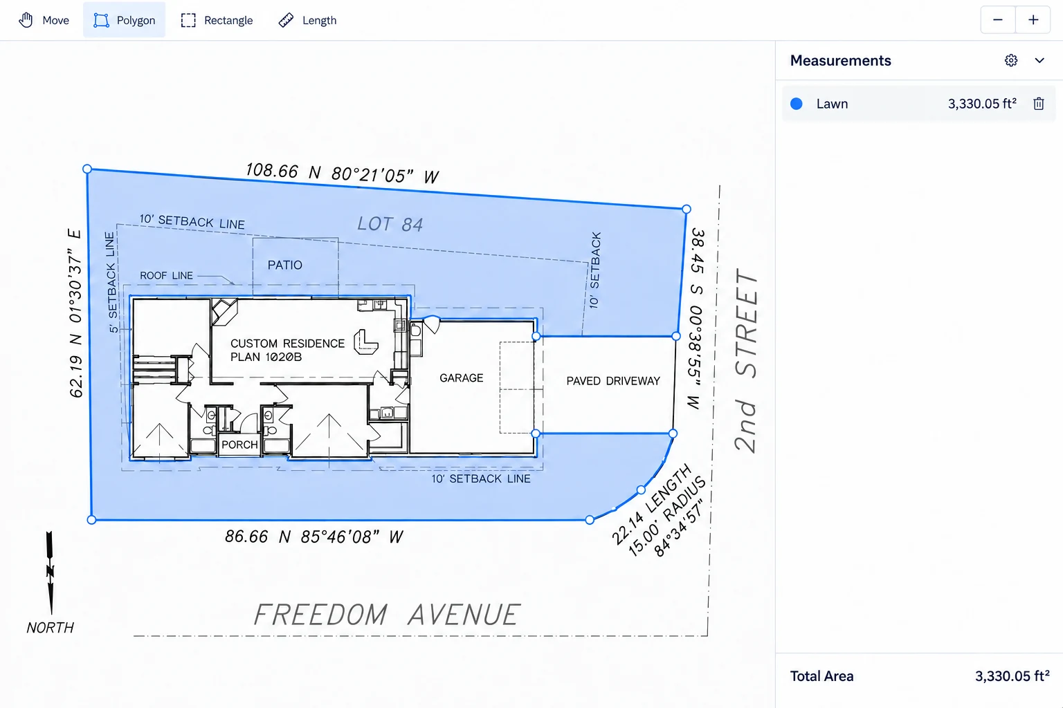
You just bought a house and the lawn needs work. The sod supplier is going to ask you one question: how many square feet?
Instead of guessing or crawling around the yard with a tape measure, you can estimate the area in about ten minutes. All you need is a drawing of your property and Areaplane's Floor Plan Calculator.
We will walk through a real example using this corner lot site plan. It has labeled dimensions, a house footprint, a patio, a garage, and a paved driveway. By the end, we will have an area estimate to check with the supplier.
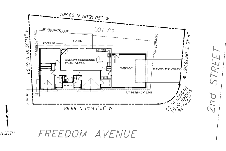
Step 1: Get an Image of Your Property
Find a document that shows your lot boundaries and the footprint of structures. Common options:
- Site plan from your builder or architect
- Property survey from your home purchase
- Municipal property map (many cities publish these online)
- A screenshot from Google Maps as a last resort
In our example, we have a site plan for Lot 84 on a corner of Freedom Avenue and 2nd Street. It shows labeled boundary dimensions plus the house, garage, patio, porch, and paved driveway. Use the dimension attached to the exact line you calibrate.
Scan it or take a clear photo. Make sure the full property is visible and the image is not rotated.
Step 2: Upload It to Areaplane
Open the Floor Plan Calculator and upload your JPG, PNG, or PDF. Your plan is processed locally; website usage analytics are described in the privacy policy.

The upload panel accepts a reference image or a saved project. For a synthetic practice file with no property information, download the L-shaped room sample.
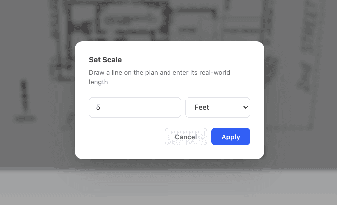
Step 3: Set the Scale
The site plan has labeled dimensions on the property boundary lines. We will use the front boundary along Freedom Avenue: 86.66 ft.
Click Set Scale, draw a line along the bottom property line from corner to corner, and type 86.66.
This single calibration step tells Areaplane how to convert pixels to real-world measurements. Check a second known dimension before tracing; a single scale cannot correct a distorted photograph.
Step 4: Trace the Lawn Area
Use the Polygon tool to trace only the area where you want sod. Follow the property boundary lines, but go around the house, garage, driveway, patio, and porch so they are excluded from the shape.
Click the first point again to close the polygon. The area appears instantly.
In our example, the lawn area comes out to 3,330 sq ft. That is the yard minus the house footprint, driveway, patio, and porch, all in one measurement.
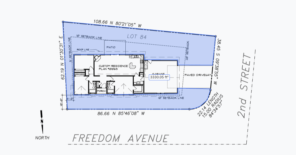
This is the fastest approach: one polygon that hugs the property boundary on the outside and wraps around the structures on the inside. No need to measure the total lot and subtract each structure separately.
Step 5: Calculate How Much Sod to Order
Ask your supplier how many square feet each roll or pallet covers. For this example, assume 450 sq ft per pallet and choose an allowance before rounding:
| Allowance | Area to order | Pallets at 450 sq ft each |
|---|---|---|
| 5% | 3,330 × 1.05 = 3,496.5 sq ft | 8 |
| 10% | 3,330 × 1.10 = 3,663 sq ft | 9 |
Eight pallets cover 3,600 sq ft, which is enough for the 5% example but not the full 10% example. If buying by area, round up to the supplier’s unit of sale. Confirm the allowance for curves, cuts, and site conditions with the supplier or installer.
Tips for Accurate Results
- Zoom in when placing polygon points, especially where you trace around the house corners and the curved street corner. Small placement errors add up.
- Use the highest resolution image you can get. A 300 DPI scan will give you much cleaner edges than a phone photo.
- Double-check with a tape measure on one dimension if possible. Walk outside and measure your driveway width, then compare it to what Areaplane shows. If they match, your scale is correct.
- Save your project. Click Download to export a backup file. If you come back to do another phase of landscaping later, you can reload the project and adjust without starting over.
What if you don't have a site plan?
If you don't have a property document, you can use the Google Maps Area Calculator instead. Search your address, switch to satellite view, and trace your lawn area the same way. Check visible edges against an on-site dimension. Shadows, trees, and outdated imagery can change the estimate.
The Floor Plan Calculator is more precise when you have a scaled document with labeled dimensions, but either tool gets the job done.
Summary
- Get a site plan or survey of your property
- Upload it to Areaplane and set the scale using a labeled dimension
- Trace the lawn area with the polygon tool, going around the house and driveway
- Divide the square footage by your supplier's pallet coverage
- Order 5-10% extra for cutting waste
Ten minutes of tracing on a screen saves you from ordering too many pallets or making an extra trip to the sod farm.
Plan Watering before Laying Sod
If you also need a sprinkler layout, use the Irrigation Planner and residential sprinkler guide. Confirm the water supply and coverage before ordering installation materials. For a full project that uses these steps from start to finish, see the new build landscaping walkthrough.