
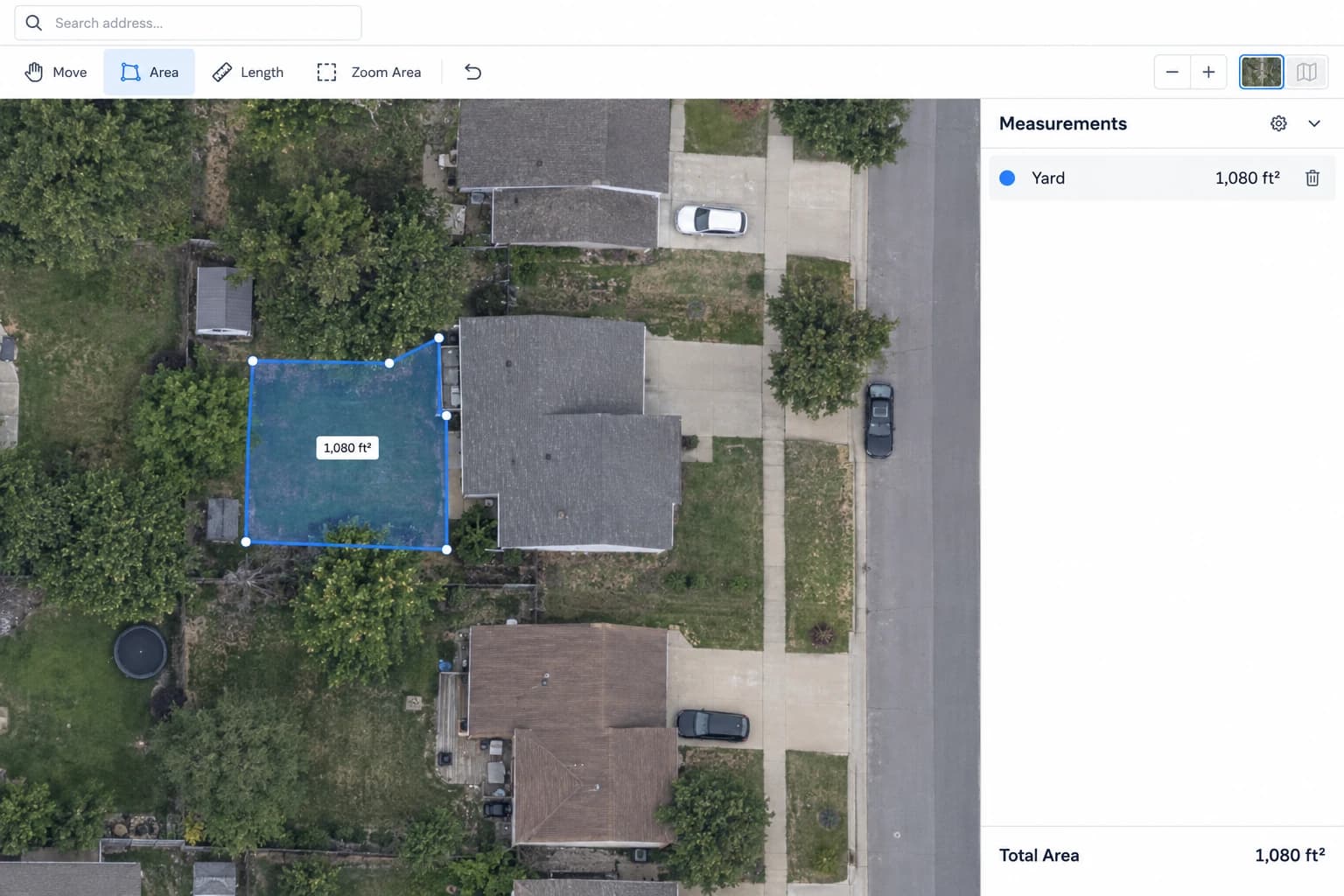
To estimate area on a satellite map, search an address, trace a closed polygon, and read its area. Areaplane’s Google Maps Area Calculator supports multiple named areas and downloadable projects.
Google Maps and Areaplane
Areaplane is an independent tool. Its satellite layer comes from Esri and its road map from OpenStreetMap; it is not affiliated with Google. If you already use Google Maps to find a property, search the same address in Areaplane to organize and save your measurements.
1. Find the Site and Check the Imagery
Open the map tool and search the address. Switch between Satellite and Road as needed. Check that buildings and landscape features match the current site. Older imagery, tree cover, and deep shadows may hide the edges you need.
2. Trace the Area
Choose Area, click around the visible boundary, and click the first point to close the polygon. Follow the edge of the surface you need to measure, such as lawn or paving. For a fence estimate, choose Length and trace the proposed route instead.
Name separate measurements clearly. Measuring the whole yard and patio as two polygons does not automatically subtract the patio: subtract its area when calculating your net lawn area.
3. Check an Example by Hand
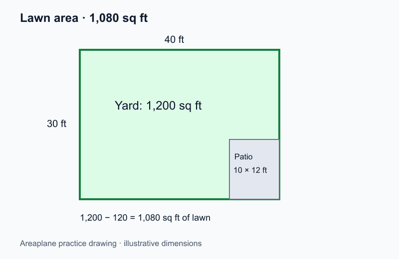
This drawing is a hypothetical example, not a satellite image. Download it to follow the arithmetic or practice with the floor plan tool.
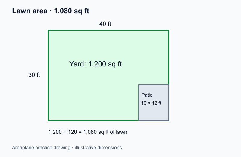
| Measurement | Calculation | Result |
|---|---|---|
| Whole yard | 40 × 30 | 1,200 sq ft |
| Patio | 10 × 12 | 120 sq ft |
| Lawn | 1,200 − 120 | 1,080 sq ft |
| Example 5% cutting allowance | 1,080 × 1.05 | 1,134 sq ft |
The map displays square feet or square meters. Divide square feet by 43,560 to calculate acres: 1,080 sq ft is approximately 0.0248 acres. For sod ordering, use the full lawn and pallet walkthrough.
4. Save and Verify
Download a project file to preserve your polygons. Your measurements are saved locally in your browser. Map tiles and address searches use external map services, and site usage analytics are described in the privacy policy.
Compare at least one length against a known dimension on site. More decimal places do not imply greater accuracy: imagery resolution, capture angle, and tracing all affect the result.
Roofs and Property Boundaries
A traced roof outline estimates the horizontal footprint, not the sloped surface. Use the roof pitch example before estimating roof materials or panel space.
A fence, hedge, or visible lawn edge is not proof of a legal property boundary. Use survey records or a qualified surveyor for boundary decisions. This map does not provide a legal parcel layer.
For sprinkler layouts, carry your verified dimensions into the Irrigation Planner and work through the sprinkler design guide. For a full project that uses these steps from start to finish, see the new build landscaping walkthrough.